Drone Authority · Owner guide · Portable thermal drone
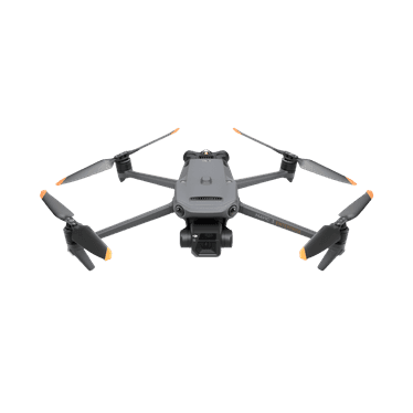
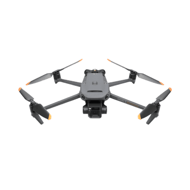
DJI Enterprise Mavic 3 Thermal
Built from official manuals, FAA records, current support pages, and model-specific compatibility checks. It is an ownership guide, not a hands-on review.
Ownership brief
Qualified inspection, public-safety, and search teams that need portable thermal capture and have a documented interpretation and reporting workflow.
Price band only. Official manufacturer page. We earn no commission.
- Typical price
- Dealer quote
- Category
- Portable thermal drone
Owner desk
Mature enterprise workflowLiving with the Mavic 3 Thermal.
The Mavic 3 Thermal is a capture and documentation system, not an automatic diagnosis tool. Build every mission around the target, expected thermal contrast, environmental conditions, qualified interpretation, and required report.
Configuration
Portable thermal inspection system
Weight
920 g according to DJI
Legal configuration
Registration, Remote ID, and what changes them.
Approved accessories, lights, speakers, and RTK hardware change the operating configuration. Track installed hardware and its effects on endurance and sensing.
- Recreational
- FAA registration is required because the aircraft is over 250 g.
- Part 107
- Register the exact aircraft in the Part 107 inventory and meet mission-specific training, airspace, site, privacy, and client requirements.
- Remote ID
- Confirm the accepted declaration, serial, firmware, and live broadcast during fleet acceptance and after major service or configuration changes.
- Control stack
- DJI Pilot 2 on RC Pro Enterprise
First 30 minutes
Set it up before the launch site.
- 01
Define the inspection question
Write what condition the client wants found, what thermal contrast should reveal it, who is qualified to interpret it, and what supporting visual evidence is required.
- 02
Configure the enterprise stack
Set organization access, return behavior, sensing, storage, thermal palette and range, emissivity assumptions, visual camera defaults, and naming conventions.
- 03
Build a controlled thermal exercise
Use a known warm and cool target, compare thermal and visual views, vary angle and distance, and observe reflections and environmental changes.
- 04
Prove the report workflow
Export radiometric and visual files, preserve metadata, analyze with the intended software, label limitations, and have the qualified reviewer approve the format.
Compatible kit
What to buy first.
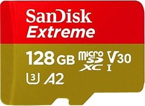
Buy official batteries, charging, and support through an enterprise dealer. Generic field items help organization, but thermal competence comes from training, repeatable capture, calibration awareness, and reporting discipline.
What not to change
Use only supported payloads and interfaces. Keep visual, thermal, and sensing windows clear, and do not treat a third-party mount as evidence of airworthiness or data validity.
Amazon links are affiliate links. We may earn a commission at no extra cost to you. Fit notes and ordering are editorial decisions.
02 · Buy first
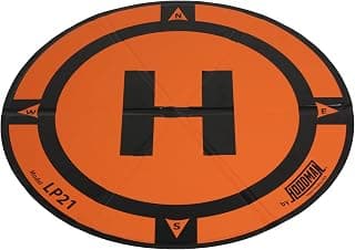
LP21 Weighted Drone Landing Pad
The field accessory that actually earns its space.
Check at AmazonMaintenance
What to check, and how often.
- Before every mission
- Run the operator checklist for aircraft, props, battery, sensors, storage, controller, RTK or correction link, payload, weather, airspace, and client site.
- After every mission
- Quarantine questionable batteries or aircraft, copy and verify data, sync logs, record anomalies, and preserve the configuration used for the deliverable.
- On the program schedule
- Track battery cycles, firmware, calibration status, propeller hours, repairs, controller state, and required organization approvals by aircraft serial.
- Before a software or firmware change
- Review release notes, export settings, test the complete aircraft-controller-payload-software stack, and document rollback or support procedures.
Troubleshooting
Common symptoms and what to check.
The thermal image shows a surprising hot or cold area
Check emissivity, reflected temperature, angle, distance, wind, sun, moisture, focus, thermal range, and a matching visual reference before interpreting it.
Do not diagnose electrical, structural, medical, or safety conditions outside the operator's qualified scope.
Thermal and visual views do not align
Confirm camera mode, zoom, focus, distance, gimbal calibration, firmware, and whether parallax at close range explains the offset.
Do not use a mismatched overlay as precise location evidence.
Radiometric files will not analyze correctly
Confirm the original file type and metadata, supported DJI analysis software, export path, firmware, and that the capture mode recorded temperature data rather than a display image.
Do not issue measurements from screenshots or stripped files.
Official support
Manuals, firmware, parts.
Learn next
Where to go next.
- Commercial requirementsBuild the regulatory stack around the actual mission.
- Drone operations plannerScope aircraft, crew, airspace, site, weather, and deliverable constraints.
- Commercial mission guidesConnect capture, processing, control, QA, and the final deliverable.
- Can I fly here?Check the launch point before building the mission plan.
Published figures
- Weight
- 920 g
- Thermal
- 640x512 radiometric thermal camera
- Visual cameras
- 48 MP wide plus tele camera
- Flight time
- 45 min published maximum
- Control
- DJI RC Pro Enterprise
- Sensing
- Omnidirectional binocular vision plus downward infrared
Against the 250 g registration line
920 g
Above the line. Register this aircraft with the FAA before you fly it, recreationally or under Part 107, and meet Remote ID. Registration rules
Ownership strengths
- Integrated 640x512 thermal, wide, and tele views in a portable aircraft
- Published 45-minute maximum and omnidirectional sensing
- Enterprise controller and DJI software workflow for inspection and response teams
Best fit. Qualified inspection, public-safety, and search teams that need portable thermal capture and have a documented interpretation and reporting workflow.
Owner cautions
- Thermal imagery is not self-interpreting and can be distorted by emissivity, reflection, distance, and weather
- Not a substitute for a licensed or qualified diagnosis where the job requires one
- Batteries, training, software, reporting, and support should be budgeted with the aircraft
Look elsewhere if. Thermal imagery is not self-interpreting and can be distorted by emissivity, reflection, distance, and weather
What the DJI Enterprise Mavic 3 Thermal is
The Mavic 3 Thermal combines a 640x512 thermal camera with wide and tele visual cameras in a portable enterprise airframe. Useful thermal work requires mission-specific training, emissivity and reflection awareness, repeatable capture conditions, and qualified interpretation.
This page is organized around setup, legal configuration, exact-fit parts, maintenance, troubleshooting, and current official support. It is not presented as a hands-on Drone Authority review.
Shopping for the DJI Enterprise Mavic 3 Thermal?
Typical price Dealer quote. Check availability before you commit.
Compare with
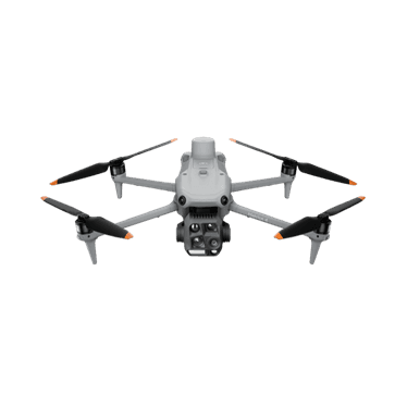
DJI Enterprise
Matrice 4E / 4T
DJI's Matrice 4 Series splits into two mission systems: the 4E for precision mapping and the 4T for thermal inspection and public safety. Procurement should begin with the deliverable, payload, software, training, and support plan rather than the airframe alone.
Strengths
- Clear 4E mapping and 4T thermal/public-safety mission split
- Published 49-minute maximum endurance and a compact integrated sensor stack
- DJI Pilot 2, FlightHub 2, RTK, and SDK paths for managed operations
Tradeoffs
- Not waterproof according to DJI's own FAQ
- Dealer, software, training, battery, and support costs matter more than the airframe quote
- 4E and 4T camera capabilities are materially different and must not be treated as one payload
- Variants
- 4E mapping; 4T thermal and public safety
- Weight
- 1,219 g with standard propellers
- Flight time
- 49 min published maximum
- 4E imaging
- 4/3 20 MP wide camera with mechanical shutter
- 4T sensing
- Wide, medium tele, tele, 640x512 thermal, laser, NIR
- Control
- RC Plus 2 Enterprise with DJI Pilot 2
Best for: Organizations building a defined mapping, inspection, thermal, or response workflow with trained pilots, data handling, and enterprise support.
Amazon comes first when available. Official links stay visible for exact specs, stock, and manufacturer support.
DJI Enterprise
Mavic 3 Enterprise
The Mavic 3 Enterprise is DJI's portable mechanical-shutter mapping aircraft. It is compact enough for a small field team, but accurate deliverables still depend on RTK or control, flight planning, capture geometry, processing, quality checks, and local surveying rules.
Strengths
- Mechanical-shutter 4/3 camera built for efficient mapping capture
- Optional RTK workflow in a portable 915 g aircraft
- Published 45-minute maximum and integrated enterprise controller
Tradeoffs
- The aircraft alone does not create survey-grade deliverables
- RTK, base or network corrections, software, control, and QA add cost and complexity
- Mapping authority and deliverable standards vary by jurisdiction and client
- Weight
- 915 g
- Camera
- 4/3 20 MP wide camera with mechanical shutter
- Flight time
- 45 min published maximum
- Positioning
- Optional RTK module
- Control
- DJI RC Pro Enterprise
- Sensing
- Omnidirectional binocular vision plus downward infrared
Best for: Mapping and inspection teams that need a portable mechanical-shutter aircraft and already understand positioning, processing, QA, and deliverable requirements.
Amazon comes first when available. Official links stay visible for exact specs, stock, and manufacturer support.
Aircraft to operation
Before first launch
Buying the aircraft is one decision. Use this sequence to get from the box to a deliberate, legal first flight.
Aircraft under consideration
DJI Enterprise Mavic 3 Thermal
DJI Enterprise Mavic 3 Thermal: 920 g
- 01Check registration
Aircraft status
Set the registration path
DJI Enterprise Mavic 3 Thermal is listed at 920 g. Plan on registration before launch. Part 107 registration is per aircraft.
- 02Start the airspace check
Launch location
Check the exact airspace
The aircraft does not decide whether a location is clear. Check the launch point, planned altitude, date, and time for controlled airspace, restrictions, and local launch rules.
- 03Check commercial requirements
Likely work aircraft
ConditionalClear the commercial requirements
DJI Enterprise Mavic 3 Thermal is commonly considered for paid or business work. Confirm the pilot certificate, aircraft registration, Remote ID, airspace, and mission-specific requirements before quoting the job.
- 04Open the first-flight checklist
Props still off
Run the first-flight preflight
Confirm aircraft condition, firmware, battery health, controller link, home point, return-to-home settings, weather, people, obstacles, and the lost-link plan before takeoff.
How this guide is built
This guide draws on official manuals and support pages, FAA Remote ID records, published specifications, and compatibility data. It separates confirmed exact-fit parts from universal gear, and it does not imply we have flown the aircraft.
Affiliate relationships do not change our scores or rankings. Read the full affiliate disclosure.