Drone Authority · Gear
Drone payloads explained: thermal vs LiDAR vs multispectral (2026)
By Joel Kelly
Last updated July 18, 2026; facts re-checked September 26, 2026. Sensor lines move fast: treat specific model claims as a snapshot and verify current spec sheets.
The short answer
Each sensor answers a different question
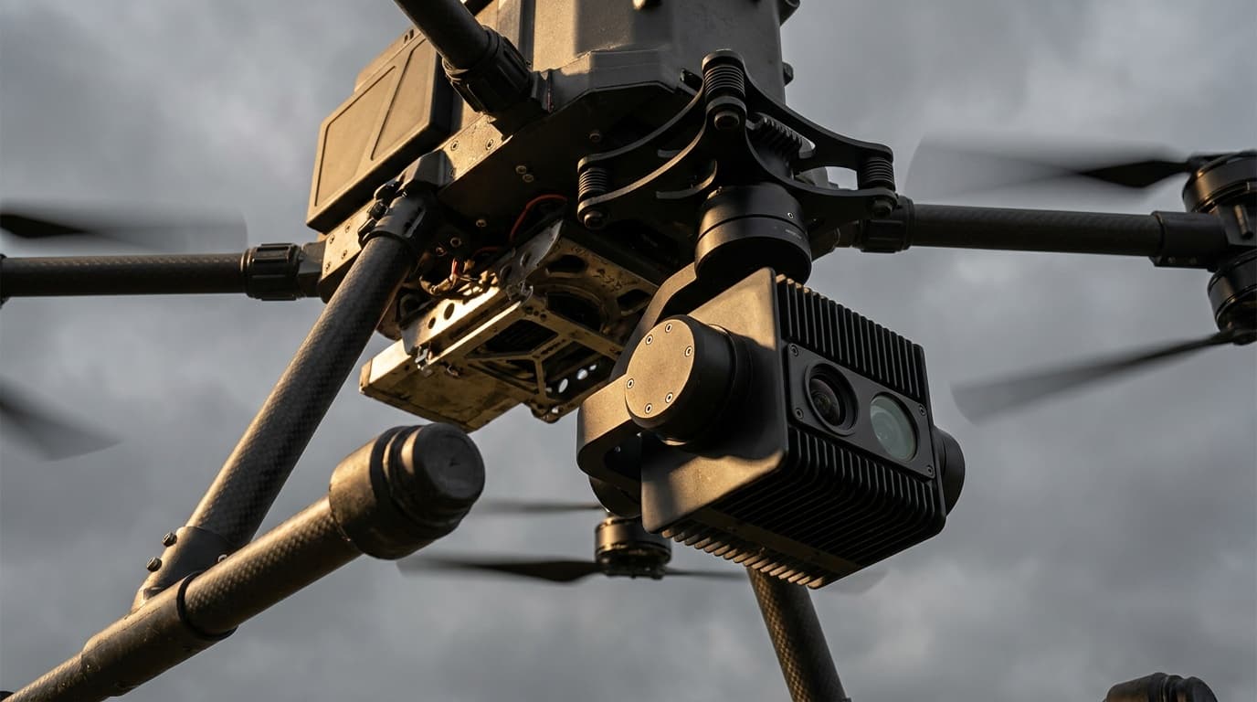
RGB answers “what does it look like?” Thermal answers “what temperature is it?” LiDAR answers “exactly where is every surface, even under trees?” Multispectral answers “how healthy is this vegetation?” Pick the question first and the payload picks itself: the decision table below maps nine common missions.
Thermal: measuring heat, not seeing in the dark
Thermal cameras image emitted infrared radiation: surface temperature, not light. The professional split that matters is radiometric vs non-radiometric: radiometric sensors store a temperature value per pixel, so imagery remains analyzable after the flight (tap a panel, read 78.4°C, adjust emissivity, generate a report). Non-radiometric gives a pretty heat picture and nothing more. Working resolution standard for inspection is the 640×512 class; what actually determines whether you can diagnose a defect is pixels-on-target: sensor resolution, lens, and standoff distance together.
The gotchas that separate professionals: emissivity (shiny metal lies about its temperature), reflected sky and sun (that “hot spot” may be a reflection), thermal crossover times of day, and wind flattening deltas. Thermal inspection is a measurement discipline that happens to produce images: certification courses (Level 1 thermography) exist for a reason.
LiDAR vs photogrammetry: the mapping decision
Both produce point clouds and elevation models; they get there oppositely. Photogrammetry computes geometry from overlapping photos: inexpensive (any good RGB camera), photorealistic, and accurate on open, textured ground with RTK/PPK positioning. It fails where it can't see or match texture: under canopy, on thin structures, on uniform surfaces, in bad light. LiDAR actively lases the scene; each pulse can return multiple times, so shots threading canopy gaps map bare earth under vegetation: the capability that defines forestry, floodplain, and corridor work. It also resolves wires and lattice structures photogrammetry smears, and works at night.
- •Choose photogrammetry when: open sites, visual deliverables (orthomosaics), stockpiles, budgets: it's the 80% answer at 20% of the hardware cost.
- •Choose LiDAR when: vegetation cover, corridor/powerline mapping, engineering-grade bare-earth accuracy, or low-light windows are in play.
- •Fly both when: the deliverable needs LiDAR geometry with photo texture: standard practice on serious survey programs.
Multispectral: the crop-stress detector
Multispectral cameras add narrow bands the eye can't separate: typically green, red, red-edge, and near-infrared. Stressed vegetation changes how it reflects these bands before visible symptoms appear. Processed into indices (NDVI for vigor, NDRE for nitrogen/late-season canopy), flights become prescription maps: variable-rate fertilizer, targeted irrigation checks, replant decisions. A calibration panel or sunlight sensor keeps values comparable across dates: the difference between pretty maps and agronomy.
The rest of the pod bay
- •Zoom / oblique RGB: the workhorse inspection payload: hardware defects, standoff detail, documentation. Underrated because it isn't exotic.
- •Gas detection: OGI thermal visualizes hydrocarbon plumes; TDLAS lasers measure methane concentration for pipeline and landfill surveys.
- •Spotlights, speakers, drop mechanisms: public-safety and SAR accessories that turn a camera drone into a response tool.
- •High-accuracy positioning (RTK/PPK): not a sensor, but the multiplier that turns any mapping payload from 'roughly there' into survey-grade.
Decision table: payload by mission
| Mission | Primary payload | Pair with | Why |
|---|---|---|---|
| Roof / building envelope inspection | Radiometric thermal | High-res RGB zoom | Moisture intrusion and insulation gaps show as temperature deltas after sunset |
| Solar farm inspection | Radiometric thermal (640-class) | RGB for context | Hot cells, diode failures, and stringing faults are thermal signatures |
| Powerline / tower inspection | RGB zoom + oblique | LiDAR for clearance surveys | Standoff zoom finds hardware defects; LiDAR measures vegetation encroachment |
| Topographic survey, open ground | RGB photogrammetry | PPK/RTK positioning | Cheapest accurate route to orthomosaics and surface models |
| Survey under vegetation / corridors | LiDAR | Fused RGB | Multiple returns reach bare earth through canopy gaps; wires resolve |
| Crop scouting / precision ag | Multispectral | RGB | NDVI/NDRE stress mapping days ahead of visible symptoms |
| Search and rescue | Thermal (radiometric preferred) | Zoom + spotlight | Body heat vs background, day or night; zoom confirms |
| Stockpile volumetrics | RGB photogrammetry | LiDAR for dark/uniform piles | Photogrammetry handles textured piles; LiDAR when texture fails |
| Pipeline / landfill methane | TDLAS laser detector | OGI thermal | Concentration measurement along path; OGI visualizes the plume |
Carrying serious payloads means enterprise airframes, and in 2026, choosing those means navigating the compliance landscape: see our NDAA & Blue UAS guide. Flying any of this commercially requires Part 107: start at the free training hub.
Drone payloads: frequently asked questions
- What is the difference between drone LiDAR and photogrammetry?
- Photogrammetry reconstructs 3D geometry from overlapping photos: it needs good light, texture, and clear sight of the surface, and it produces photorealistic outputs. LiDAR actively fires laser pulses and measures return time: it works in low light, captures thin structures like wires, and its multiple returns can reach the ground through vegetation gaps, producing accurate bare-earth models under canopy where photogrammetry fundamentally cannot. Photogrammetry is cheaper and photorealistic; LiDAR is more accurate in hard conditions and under vegetation. Many mapping teams fly both and fuse the results.
- What does a radiometric thermal camera mean?
- A radiometric thermal camera records an actual temperature measurement for every pixel, so you can analyze the image afterward: tap any point and read its temperature, change emissivity settings, run inspections to spec. Non-radiometric cameras only render relative heat differences as a picture. For paid inspection work (solar, electrical, roofing, search and rescue documentation), radiometric is the professional standard.
- What is a multispectral drone camera used for?
- Multispectral cameras capture narrow light bands beyond visible (typically green, red, red-edge, and near-infrared) that healthy and stressed vegetation reflect differently. Processed into indices like NDVI and NDRE, the imagery reveals crop stress, irrigation problems, and variability days before the eye can see it, driving variable-rate prescription maps in precision agriculture.
- Do I need Part 107 to fly inspection or mapping payloads?
- In the U.S., yes, any flight that furthers a business (inspections, surveys, ag scouting, paid mapping) is commercial operation requiring a Part 107 Remote Pilot Certificate, regardless of drone size. Heavier sensor platforms may also push the aircraft over 55 pounds, which moves you beyond Part 107 entirely into exemption territory.
- What thermal resolution do I need for inspection work?
- 640×512 is the working standard for professional inspection thermal in 2026: enough to resolve individual solar cells or connections at practical standoff distances. Budget 256- or 336-class sensors can detect gross anomalies but force you to fly closer for diagnosis. Resolution interacts with lens focal length and distance: what matters is pixels on the defect, which is why inspection specs are written as ground sample distance or IFOV, not just sensor size.
- What payloads detect gas leaks from a drone?
- Two families: optical gas imaging (OGI) thermal cameras tuned to wavelengths where hydrocarbons absorb, which visualize plumes; and laser-based detectors (TDLAS) that measure methane concentration along the laser path, used for pipeline and landfill surveys. Both are specialist enterprise payloads flown on heavy-lift airframes.
Educational content. Sensor capabilities summarized here are general: verify current spec sheets and applicable FAA rules before purchasing or flying commercial missions.