On this page
What the work is
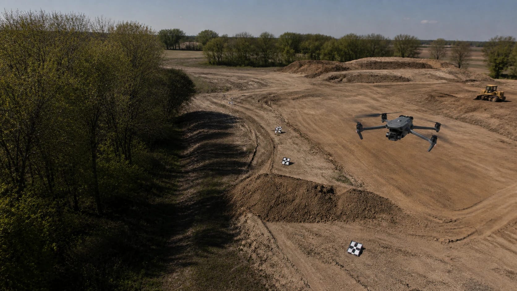
Software finds the same visual features in multiple photographs, estimates where each camera was, triangulates points in three dimensions, and builds a surface. From that surface it can generate an orthomosaic, point cloud, digital surface model, contours, mesh, or volume. A pretty stitched image is not automatically a map, and camera GPS is not automatically proof of accuracy.
The client question
What decision will this dataset support, and how accurate, complete, current, and interoperable must it be for that decision?
A beginner can learn on an ordinary RGB drone and public sample imagery. Selling measured boundaries, certified topography, design surfaces, or survey-grade claims can fall within state surveying or engineering practice. The durable entry path is visual progress mapping, planning-grade orthomosaics, or capture subcontracting under a licensed professional.
What clients buy
The output defines the job. Name the file, its acceptance test, who reviews it, and what it cannot prove before the aircraft launches.
 Output 01
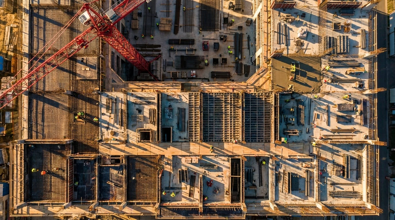
Orthomosaic
- Used for
- Site context, annotation, inventory, and repeat-date comparison.
- Check
- Coordinate system, complete coverage, and stated limitations.
- Handoff
- GeoTIFF, cloud web map, JPEG preview
Technical note
A geometrically corrected image assembled from many photographs. It is useful for site context, annotation, inventory, and change comparison when its coordinate system and limitations are documented.
 Output 02
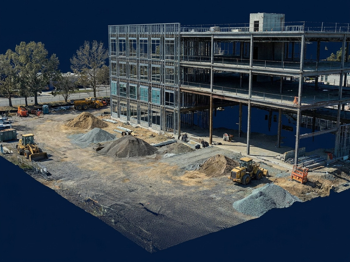
Point cloud and surface models
- Used for
- 3D inspection, DSM or DTM creation, and measurable surface work.
- Check
- Classification quality, gaps, and independently checked geometry.
- Handoff
- LAS/LAZ, GeoTIFF DSM/DTM, XYZ
Technical note
A 3D set of measured points plus a DSM or DTM. A DSM includes trees and structures; a DTM attempts to represent bare terrain and requires classification and QA.
 Output 03
Contours and volumes
- Used for
- Grade review, stockpile volumes, drainage context, and CAD handoff.
- Check
- Surface quality, base definition, units, and checkpoint error.
- Handoff
- DXF, SHP, GeoPackage, PDF report, CSV
Technical note
Derived measurements that depend on a trustworthy surface, base definition, coordinate units, and checkpoint evidence. Report assumptions and measured error with the number.
 Output 04
Accuracy and metadata report
- Used for
- Document how the dataset was made and where its limits are.
- Check
- CRS, datum, GSD, control, checkpoints, residuals, and gaps.
- Handoff
- PDF plus machine-readable project metadata
Technical note
The part that makes the imagery defensible: CRS, horizontal and vertical datum, GSD, control source, checkpoint count, residuals, gaps, capture conditions, and limitations.
From scope to handoff
- Step 1 of 6
Define the decision and acceptance criteria
Write the area of interest, output formats, coordinate reference system, vertical datum, target ground-sampling distance, delivery date, and accuracy language before planning a route.
- Step 2 of 6
Plan overlap, height, motion, and control
A common starting point is roughly 80% front and 80% side overlap, adjusted for terrain, texture, obliques, camera, and software. Decide whether camera positions alone are enough or whether the project needs RTK, PPK, ground control, and independent checkpoints.
- Step 3 of 6
Capture and inspect in the field
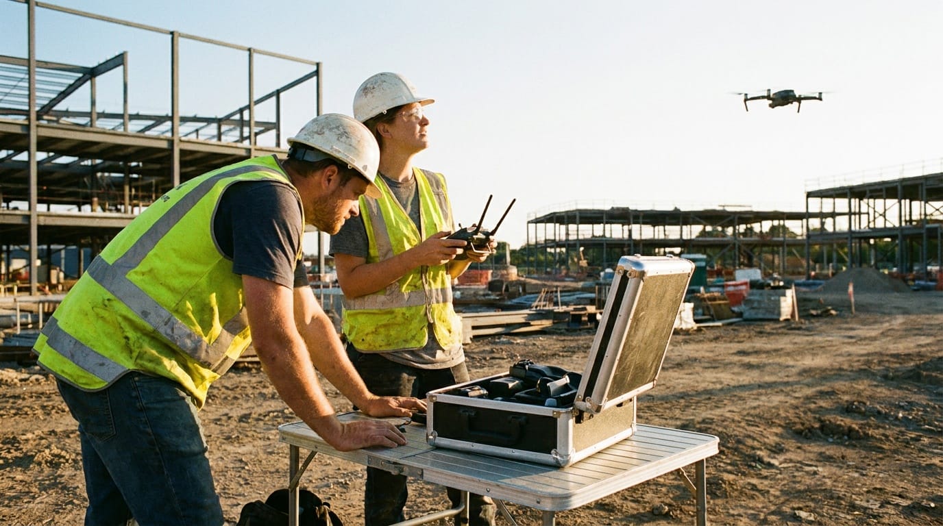
Lock an appropriate exposure strategy, avoid blur and major lighting changes, watch battery and wind margins, and check coverage before leaving. A missed strip is cheaper to refly on site than after processing.
- Step 4 of 6
Align, reconstruct, and clean
Review camera alignment and tie-point quality before generating dense products. Remove obvious artifacts, classify ground only when the workflow supports it, and retain the original imagery and processing report.
- Step 5 of 6
Validate with evidence that was not used to fit
Ground control points help shape the model. Checkpoints are withheld from adjustment and test the result. Report the actual residuals or RMSE rather than calling RTK output survey grade by default.
- Step 6 of 6
Package for the next tool
Open exported data in QGIS, ArcGIS, CAD, or the client's platform. Confirm units, northing/easting, vertical reference, scale, nodata areas, and file naming before delivery.
Equipment by capability
Buy from the accepted output backward. A more expensive sensor cannot rescue a vague scope, weak method, invalid conditions, or missing review authority.
- Capability 01RGB mapping aircraft
- A supported aircraft with a sharp camera and repeatable automated flight is enough to learn. A mechanical shutter and RTK improve demanding work but do not replace checkpoints.
- Capability 02GNSS and targets
- Survey-grade control generally requires appropriate GNSS equipment, durable targets, a known datum, and a person competent to establish and evaluate control.
- Capability 03Workstation and storage
- Photogrammetry uses substantial RAM, GPU, disk, and upload capacity. Preserve source imagery, processing reports, deliverables, and project metadata in a recoverable archive.
- Capability 04LiDAR
- LiDAR measures laser returns and can sample ground through canopy gaps. It is not a magic see-through-trees sensor; trajectory, boresight, strip alignment, classification, and checkpoints still matter.
Software by role
Flight planning, processing, GIS, asset analysis, client delivery, and job sourcing are different jobs. Confirm aircraft, controller, payload, operating-system, export, storage, and offline compatibility before paying for a subscription.
- DroneDeploy
Role
Capture, cloud processing, repeat-site comparison, and client sharing
Use it when
A team wants a managed web workflow and recurring site history.
- PIX4Dmatic / PIX4Dmapper
Role
Professional photogrammetry processing
Use it when
You need detailed processing controls, reports, and established geospatial exports.
- Agisoft Metashape
Role
Local, scriptable photogrammetry
Use it when
You want workstation processing and control over alignment, dense reconstruction, and export.
- WebODM / OpenDroneMap
Role
Open photogrammetry workflow
Use it when
You are learning, self-hosting, or need an inspectable lower-cost stack.
- QGIS
Role
GIS inspection, measurement, styling, QA, and packaging
Use it when
Always. It is a free way to verify projections and deliverables outside the processing engine.
Need the whole ecosystem? Open the drone work software guide.
How to learn the work
- Step 1 of 5
Learn coordinate systems before buying RTK
Understand raster vs. vector, latitude/longitude vs. projected coordinates, horizontal and vertical datums, units, GeoTIFFs, LAZ, and GeoPackage in the QGIS training manual.
- Step 2 of 5
Process one public dataset three ways
Run the same imagery through a local open tool and a commercial trial. Compare alignment, holes, GSD, surface artifacts, reports, and export options.
- Step 3 of 5
Repeat one small site
Fly the same legal, noncritical area several times. Keep height, overlap, camera angle, light window, and route consistent. Learn what changes break comparison.
- Step 4 of 5
Add independent checkpoints
Partner with a surveyor or rent appropriate GNSS equipment. Keep some surveyed points out of adjustment, calculate error, and write an honest accuracy report.
- Step 5 of 5
Sell the narrow output
Start with visual progress, inventories, or capture support. Do not market legal boundaries or certified topography until the licensed-professional and state-law questions are resolved.
A starter project worth showing
Field assignment
Map a five-acre practice site twice
Create a dated orthomosaic and change-comparison package for a legal site with permission. The goal is repeatability and QA, not a survey claim.
Acceptance checklist
- No missed strips or major blur
- CRS, GSD, overlap, date, weather, and aircraft recorded
- GeoTIFF opens in QGIS at the expected location
- At least three independent field checks documented
- One-page limitations and handoff note included
Where the pilot role stops
Do not sell past your competence
- Limit 01State law decides when photogrammetry, contours, boundaries, or measurable maps require a licensed surveyor or engineer.
- Limit 02GSD is pixel size on the ground, not a promise of positional accuracy.
- Limit 03RTK and PPK improve camera positions. They do not independently validate the finished surface.
- Limit 04A disclaimer does not automatically make regulated surveying unregulated.
Primary sources
These links are the starting point for current rules, methods, and professional boundaries. Vendor documentation explains a product; it does not replace the FAA, a regulator, a project specification, or a qualified reviewer.
- USGS: What is lidar data?
LiDAR concepts and formal deliverable context.
- Esri Drone2Map control guidance
Control points, checkpoints, and adjustment workflow.
- QGIS Training Manual
Free GIS curriculum for projections, raster, vector, and analysis.
- NCEES Model Law
A model definition of surveying; actual state law controls.
Next steps
Open the guide or tool that matches the next decision.
- Drone work software stackSeparate capture apps, processing engines, GIS, inspection systems, and job networks.
- Commercial drone job guideUnderstand clients, scopes, pricing, and paid-work requirements.
- Job profit calculatorPrice travel, processing, subscriptions, equipment reserve, and tax.
- Estimate the capture gridCalculate GSD, footprint, overlap spacing, photos, route distance, batteries, and field time before opening the mission app.
- Build the mission equipment systemChoose the minimum aircraft, payload, power, field, software, QA, and delivery stack.
- Build the portfolio proofTurn this work into a permissioned sample with a brief, method, finished files, QA evidence, and handoff.
- Build the legal requirement stackCheck mission, airspace, people, night, aircraft, and approval triggers.
- Price the entire missionInclude travel, capture, processing, subscriptions, insurance, reserve, and tax.
- Build the operating briefRecord the crew, aircraft, site, weather, hazards, mitigations, contingencies, and flight outcome.
- Build the system around this workConnect the deliverable to its aircraft, payload, software, support, and approval path.
- Hire an experienced providerSearch the national directory when the mission is beyond your current aircraft, training, or risk tolerance.